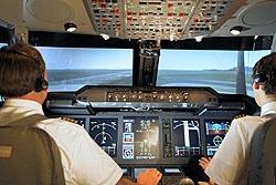
NLR has presented the impressive results of the major European Union research project, FLYSAFE (Airborne Integrated Systems for Safety Improvement, Flight Hazard Protection and all Weather Operations). During the two-day conference held on March 25-26, FLYSAFE’s innovative new features were also demonstrated in the NLR’s flight simulators.
FLYSAFE aims to make flying even safer. The project therefore focused on reducing accidents caused by collisions with other aircraft or terrain, and accidents caused by bad weather. The project, which ran for more than four years, involved 36 partners from 14 countries and had a budget of 53 million euro, officially ends in June 2009.
During the conference, the NLR’s NARSIM air traffic control simulator and GRACE (a cockpit of an A320) flight simulator were linked to each other, with air traffic controllers and pilots demonstrating FLYSAFE’s new, innovative functionalities. Additionally, the FLYSAFE project’s many achievements were presented to the conference guests in a series of briefings.
Those attending the conference were impressed by the new features developed during the FLYSAFE project, as well as by the NLR’s demonstrations of linked simulations for the conducting of operational system evaluations. The conference, moreover, enjoyed wide media coverage.
One of FLYSAFE’s new innovations involves taxiing: a map of the airport appears on the cockpit’s computer screen, with the pilot then receiving a message via data link from air traffic control, indicating which take-off runway or gate the pilot should taxi to. Normally, pilots receive these types of instructions via radio. Â One of the many benefits of this new tool is that pilots no longer need to remember the taxiing route instructions they receive from air traffic control, because this information is now permanently displayed in the cockpit, which also makes taxiing easier in low visibility conditions. This tool also shows the positions of other aircraft, with the pilots receiving warning signals should they approach too closely to another airplane while on the take-off or landing runways. This system particularly warns pilots of possible runway collisions.
A further application involves the onboard presentation of weather conditions (derived from weather radar) and the most recent weather forecasts from the ground. FLYSAFE combines these two weather data streams and presents them on the pilot’s screen in the cockpit. This allows for more comprehensive onboard analyses of areas of bad weather, allowing pilots to ‘see’ beyond the current weather radar capabilities used in aircraft today. Thus, it becomes immediately apparent what lies behind a thundercloud: is another thundercloud approaching? And how fast is it developing? This improved presentation of weather conditions ultimately aims to improve flight efficiency, flight capacity and flight safety during bad weather conditions.
The European aviation industry and the European Commission will incorporate FLYSAFE’s new technological tools and innovations in other projects, including CleanSky, a major joint technology project for developing the greener aircraft of the future, and SESAR, the Single European Sky initiative for integrating airspace. FLYSAFE’s innovations adhere to the ACARE ‘Vision 2020’ objectives and will be incorporated in the next generation of European aircraft
See also: www.eu-flysafe.org
